REMOTE SENSING - Careful archival research has yielded important evidence about the general locations of pioneer homesteads and businesses in the Merrymeeting Bay area, but pinpointing their exact locations is difficult due to the often-subtle nature of what remains of those sites. To aid our search we are employing remote-sensing technologies to enhance the visibility of potentially anthropogenic (human-made) features in the landscape. After potential features are identified via remote sensing, we then seek landowner permission to conduct on-site inspections of these features to eliminate false alarms and to determine which sites merit further study or field work.
LiDAR IMAGING - The principal remote-sensing tool in our search is airborne LiDAR (Light Detection and Ranging). LiDAR uses laser pulses to measure distances between an aircraft and the earth. When combined with aircraft location and orientation data, LiDAR data produces accurate three-dimensional data and imagery about the earth's surface, which is invaluable when seeking traces of early settlements.
Through the generous support of Quantum Spatial, Inc. in cooperation with the Maine Office of GIS, we were able to obtain new, high-resolution LiDAR data at 16ppm (16 points per square meter or better) for a small section of land along the shore of Merrymeeting Bay. We are focusing most of our LiDAR imaging efforts on this area during the current stage of our study.
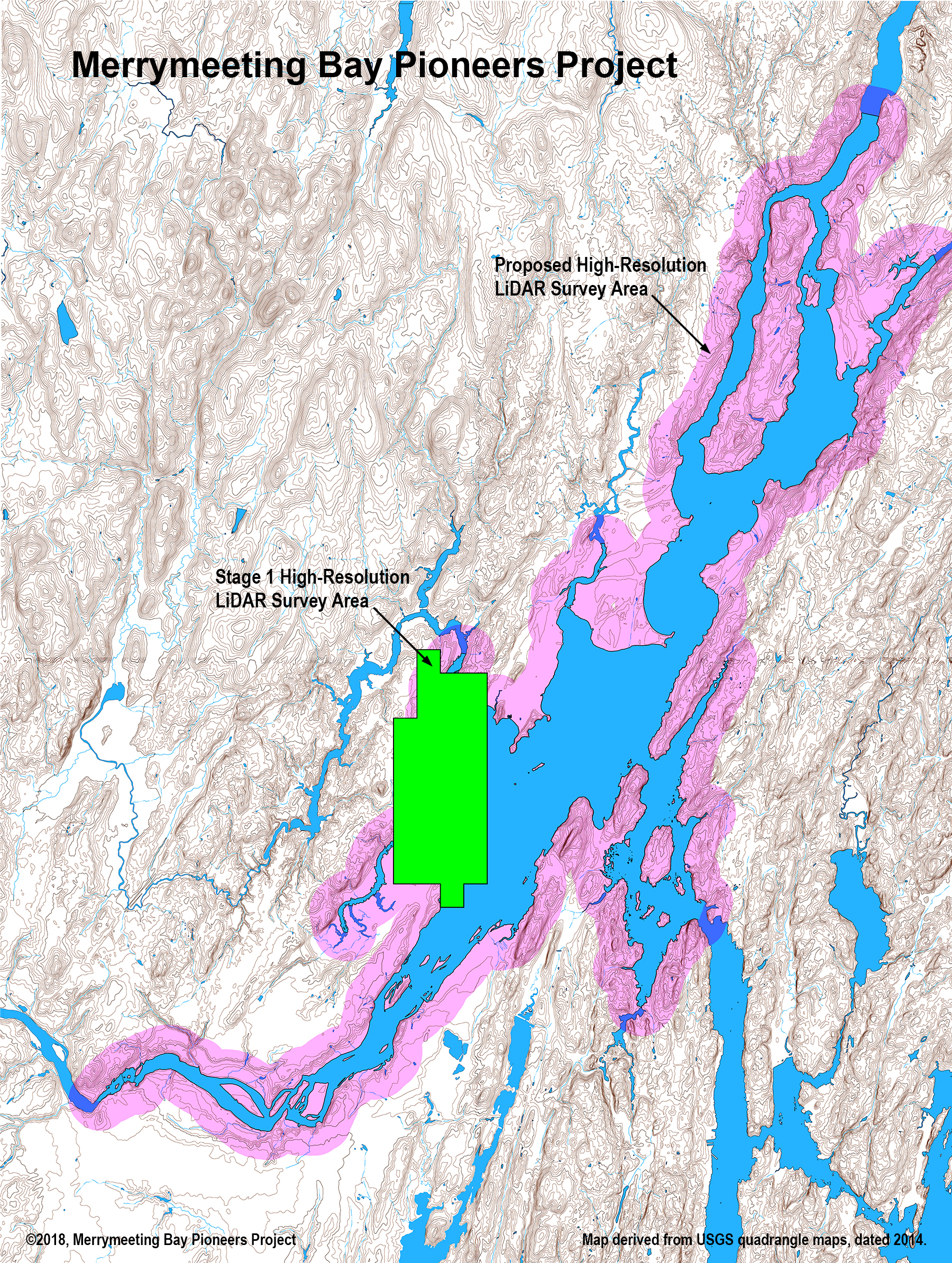
Medium-resolution LiDAR data is currently available for much of the Merrymeeting Bay area, which is also highly useful, even though its lower resolution does not provide the level of detail that we would like to have for discerning many of the subtle alterations to the landscape that are so important in locating early settlements. Major features, such as a cellar hole, a much-used road, or a sizable stone wall may be visible on the medium-resolution images, while smaller features such as foot paths, traces of nearly-leveled foundations or stone walls, wells, and privies, etc., do not show up as clearly or at all on the medium-resolution images. While we would like to have high-resolution LiDAR data for the entire Merrymeeting Bay area, budgetary restraints limit its availability, so we plan to make good use of the available medium-resolution LiDAR data to supplement our high-resolution data and help expand our search for pioneer settlements throughout the bay area. Some examples of high vs. medium LiDAR-derived images are shown below. Click on an image for a larger view.
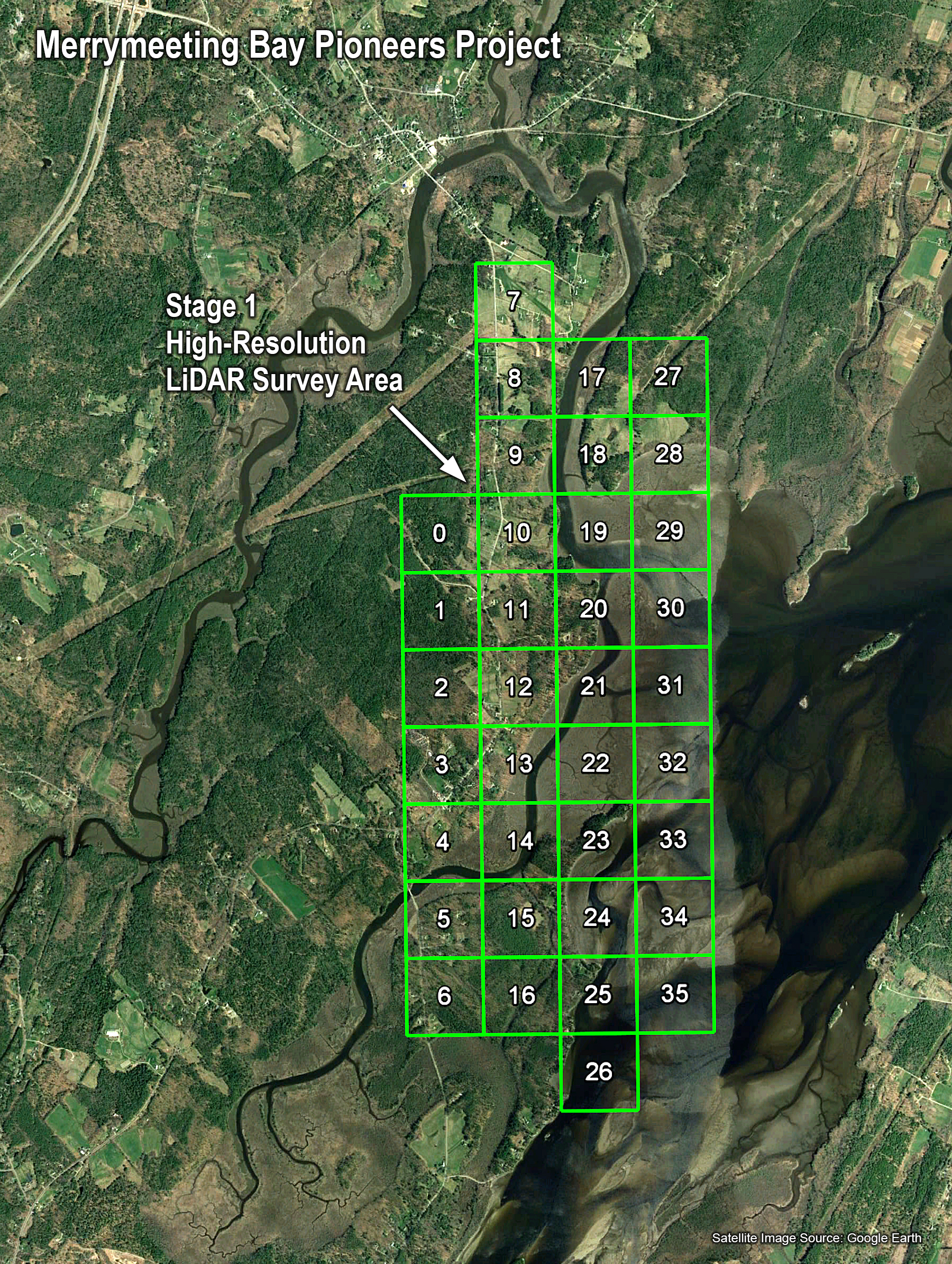

Our high-resolution LiDAR survey area is shown here superimposed over a satellite image of a portion of Merrymeeting Bay. This is our initial focus area for LiDAR-based analysis.
Future project plans include developing LiDAR-derived imagery to cover more of Merrymeeting Bay, including the area shown in pink, and possibly further inland from the shoreline.
Very subtle surface features are clear in the high-resolution LiDAR-derived images (left), although the more pronounced features are still clear in the medium-resolution images (right).
LiDAR data can be filtered, analyzed, manipulated, and displayed in many different ways. One highly useful capability for archaeologists is to filter out vegetation and other objects to produce "bare-earth" imagery, which is of great value for our study, since traces of human habitation and other alterations to the terrain are easily obscured by trees and shrubs, as shown in the examples below.
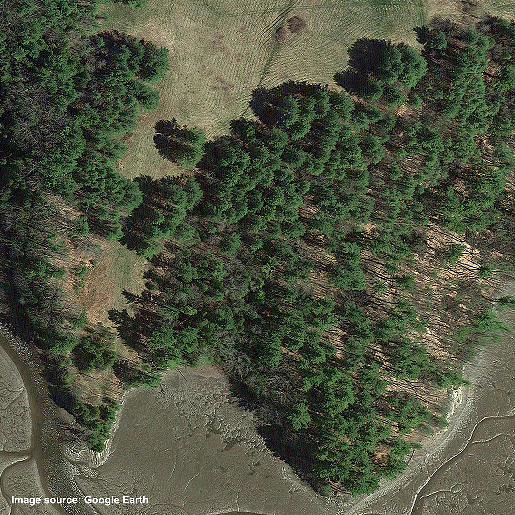


In this satellite photo, only the largest human modifications to the surface are visible. Many subtle features are hidden by vegetation or else not visible in this type of image.
This LiDAR-derived image of the same area includes vegetation and other objects. When seeking signs of early settlements, we usually want to filter out any non-ground objects.
Here, trees, shrubs, and other above-ground objects have been filtered out, leaving a "bare-earth" image that displays additional surface modifications of varying age.
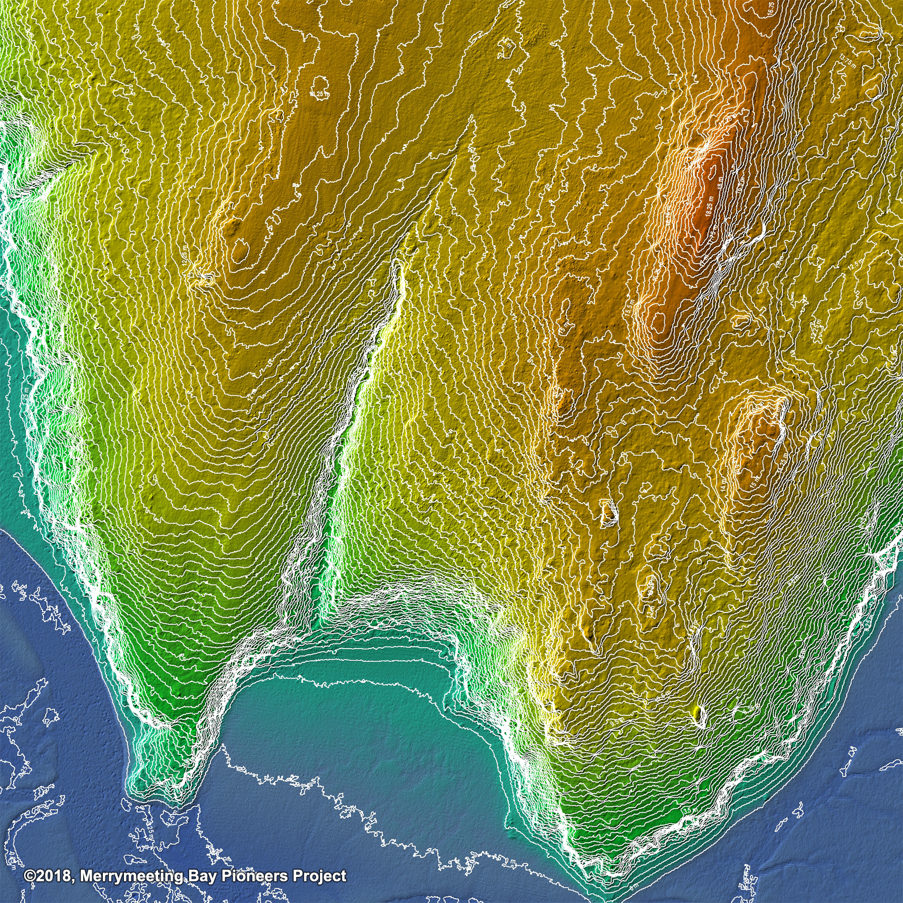
Accurate contour maps are just one of many products that we have derived from our LiDAR survey data. This example has very close 25 cm (9.8”) contour intervals.
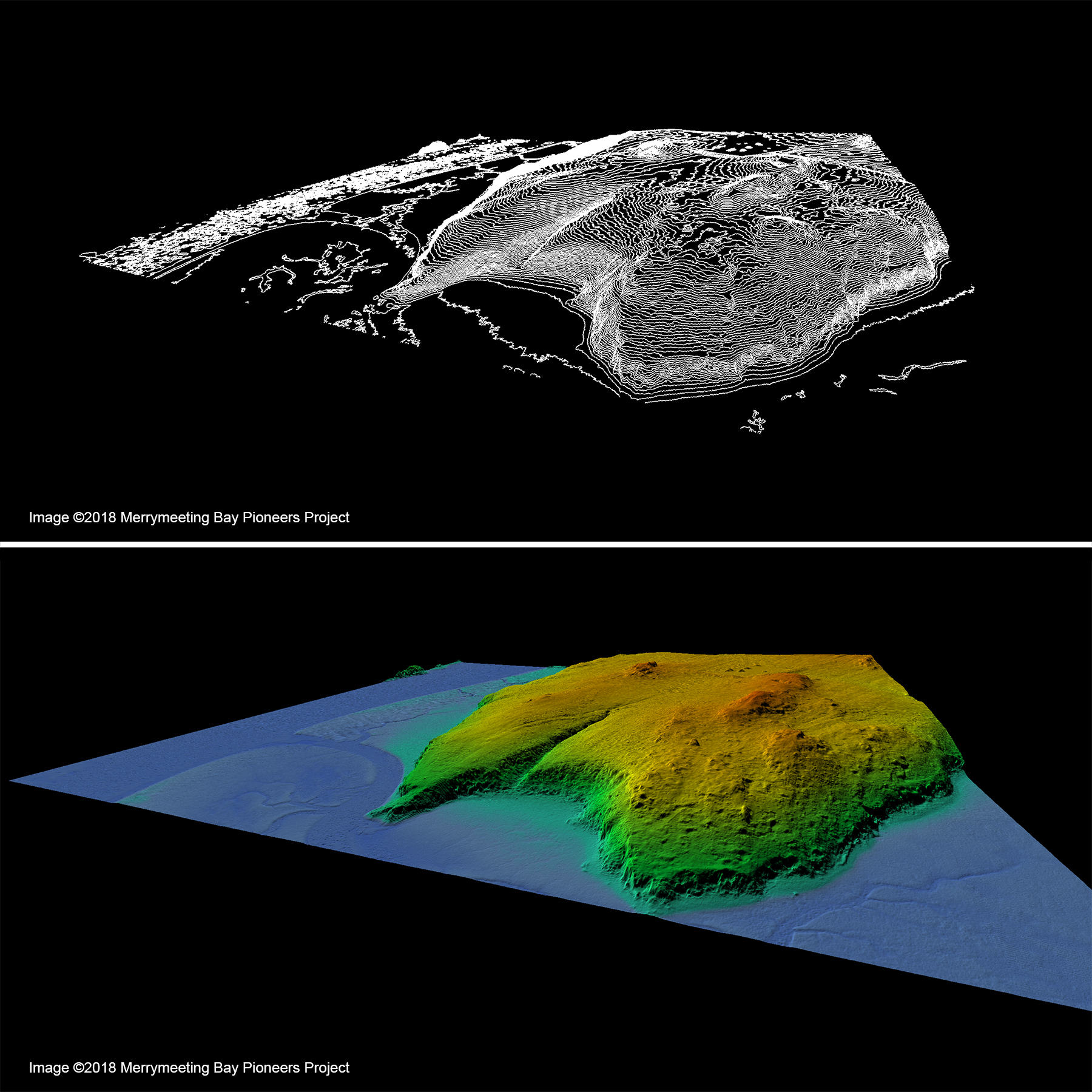
We have derived 3D imagery, both static and dynamic, from our LiDAR survey data, providing many new and useful ways of looking at geographic information.
There are many ways of manipulating LiDAR-derived data and imagery that we have found helpful for analyzing landscape features, such as profile analysis, as shown here.
Geographic Information Systems (GIS) - Our initial use of GIS software has been its ability to convert, manipulate, display, and analyze LiDAR survey data, as described above.
However, it also provides a means of recording, storing, managing, presenting, and analyzing an almost unlimited range of geographic/spatial data and any associated information, as well as linking to outside sources. It is a powerful database tool for historians and archaeologists, who can record historical or archaeological data related to physical locations and view and analyze that data in the context of the geographical settings.
For example, as we examine potential features on the ground and identify sites of historical interest, we plan to enter those sites on GIS-based maps and enter information about those sites in a GIS database.
Detailed artifact data can be entered into a spreadsheet or relational database, which can then interface with the GIS database. This would allow us to select a site on a GIS map and instantly view all of the artifacts and other site details associated with that site. It could also allow us to perform database queries to, for instance, locate all sites that have certain combinations of characteristics, artifacts, etc.
As our study progresses, given enough data, we might eventually be able to create a predictive model based on known site characteristics that would be helpful in locating likely locations to explore for finding lost sites.
Other Remote Sensing Technologies - As our study moves forward, we may take advantage of a multiplicity of remote-sensing methods and technologies, which might include infrared and near-infrared aerial imaging, ground penetrating radar, precessing proton magnetometry, ferrous and non-ferrous metal detection, and so forth, as appropriate for the nature of the site as well as time and budgetary considerations.
Analytical and Preservation Technologies - Excavation work often produces artifacts that can be analyzed to yield a wide range of information. Subjecting artifacts to laboratory analysis may be very helpful for learning more about various aspects of an occupation. This is something that we may apply on a case-by-case basis, depending on a combination of artifact types, time, budget constraints, and the likelihood of gaining valuable/significant information from the analysis.
Website ©2018, Merrymeeting Bay Pioneers Project